Mobile App Development
Our goal is to continuously leverage the achievements of the 21st century, further develop them as needed, and—by involving technical tools enabled by infocommunications—support improved safety and assist the work of authorities in a comprehensive way. We contribute to their activities through the following:
For many years, our association has been developing various mobile applications and software solutions, whether related to transportation, disaster situations, navigation, or the protection of citizens. RSOE is committed to technological innovation in order to provide solutions in a wide range of scenarios. Our main objective is to increase public safety through our developments and to support efficient information flow in emergencies. The applications we develop help authorities and citizens respond quickly and minimize damage in critical situations. We pay special attention to ensuring that our systems are easy to use and accessible to everyone. We are proud that RSOE solutions have proven effective in many areas worldwide.
VÉSZ
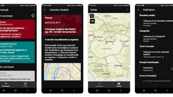
The BM OKF Emergency Notification Service (VÉSZ) is an application developed to inform people in areas affected by an expected or ongoing natural disaster or industrial accident that may endanger life and property, and possibly the environment. The app displays informational, warning and alert messages issued by disaster management.
Download the app:


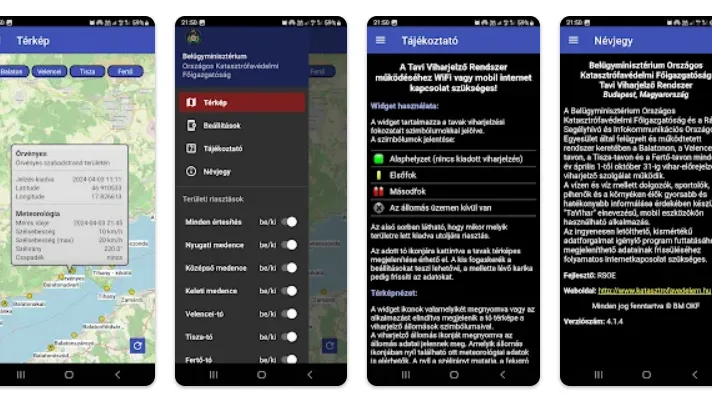
TAVIHAR
The mobile version of the program—also continuously available on our website—that provides information about storm hazards on Hungary’s navigable lakes was developed by the engineers of the National Association for Radio Emergency Calls and Infocommunications.
Pursuant to the (amended) Ministry of the Interior Decree 46/2001 (XII. 27), a storm forecasting and storm warning service operates on Lake Balaton, Lake Velence, Lake Tisza and Lake Fertő every year from 1 April to 31 October.
The system supervised and operated by the National Directorate General for Disaster Management of the Ministry of the Interior (BM OKF) and RSOE also provides information about the current storm situation on the lakes via the directorate’s and the relevant county directorates’ websites.
In order to inform people working, exercising, relaxing on or near the water—and residents in the area—
faster and more effectively, the “TAVIHAR” widget application was developed for mobile devices.
The free app is optimized for Android and iOS smartphones and tablets.
To run the application and refresh its displayed data (which requires minimal data usage), a continuous
internet connection is required.
Download the app:
EDIS
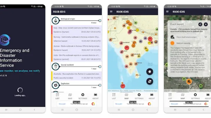
RSOE-EDIS is a service launched in 2004 that provides consolidated, consistent and—where possible—verified information about natural and human-induced emergencies and disasters occurring around the world.
To achieve this goal, our team continuously monitors various sources (cooperating partners, governmental and civil organizations, and the media) for relevant information. We collect, organize, and often cross-check these inputs multiple times, then publish them on the RSOE-EDIS website, which is accessible to everyone.
Our service monitors events 24/7, and we currently publish various human-induced or natural events in 42 categories, such as: earthquakes, volcanic activity, tsunami, floods, drought, epidemics, major industrial accidents (nuclear power plants, chemical and other industrial facilities), major incidents affecting transportation infrastructure, and fires (vegetation and industrial).
Download the app:
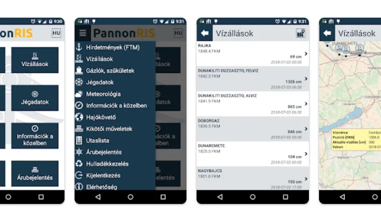
PANNONRIS
River Information Services (RIS) are harmonized information services that support inland waterway traffic and transport management, including—where technically feasible—links to other modes of transport.
In Hungary, the PannonRIS system is continuously developed and operated within the cooperation of the relevant national authorities and RSOE (National Association for Radio Emergency Calls and Infocommunications).
The PannonRIS mobile application provides the following informational data—continuously updated—for the Hungarian section of the Danube, free of charge to stakeholders in inland navigation:
- water level data
- notices to skippers
- shallow-water / fairway conditions
- ice information
Download the app:
ADDITIONAL SERVICES

Training with VR technology
Our Aurin VR development team has been creating interactive VR applications for several years. We build them primarily in Unity and optimize them for Meta Quest 2 and 3 devices. Our current offering is a VR application package designed to practice road traffic rules, focusing on micromobility devices and supporting users with interactive scenarios to better understand safe traffic situations.

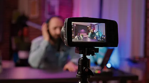
Photo and film production
With our equipment, we produce professional-quality photos and videos for a wide range of needs. These materials greatly support preventive work by authorities, as our high-quality content helps deliver accident-prevention programs effectively. Such outputs represent added value that can significantly enhance public safety effectiveness and contribute to a stronger sense of security.
Live streaming
Our system is particularly well suited for streaming conferences, press briefings, sports events and other programs online, which we can broadcast live on various websites. We provide professional, high-resolution live streams and support the required internet connection with on-site technical infrastructure. Real-time broadcasting enables audiences to follow events interactively while we maintain quality standards.